


Bali Island Map ~ Circa 1592 ~ Framed
SGD 78.80
Bali Island, originally published around the year 1592 in Europe. The map is oriented with south at the top and contains topographical details such as mountains rivers and forests, as well as 3 European ships to the left of the island and an inset of the Balinese kings palace.
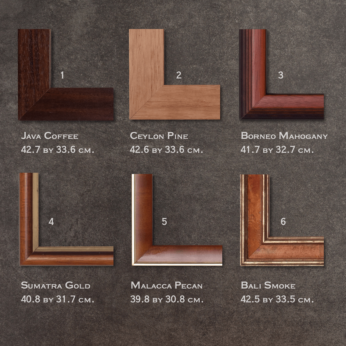
Size 42.6 by 33.6 cm
Quality Recycled Art Paper
Mounted with Thick Art Cardboard
Wooden Frame and Glass
Description on the Back
Our framed art prints are printed on recycled uncoated speckled art paper and framed with eco-friendly wood.
Quantity: